
Earthquake
An Earthquake is a shaking of the earth's surface by energy waves emitted by slowly moving tectonic plates overcoming friction with one another underneath the earth's surface.
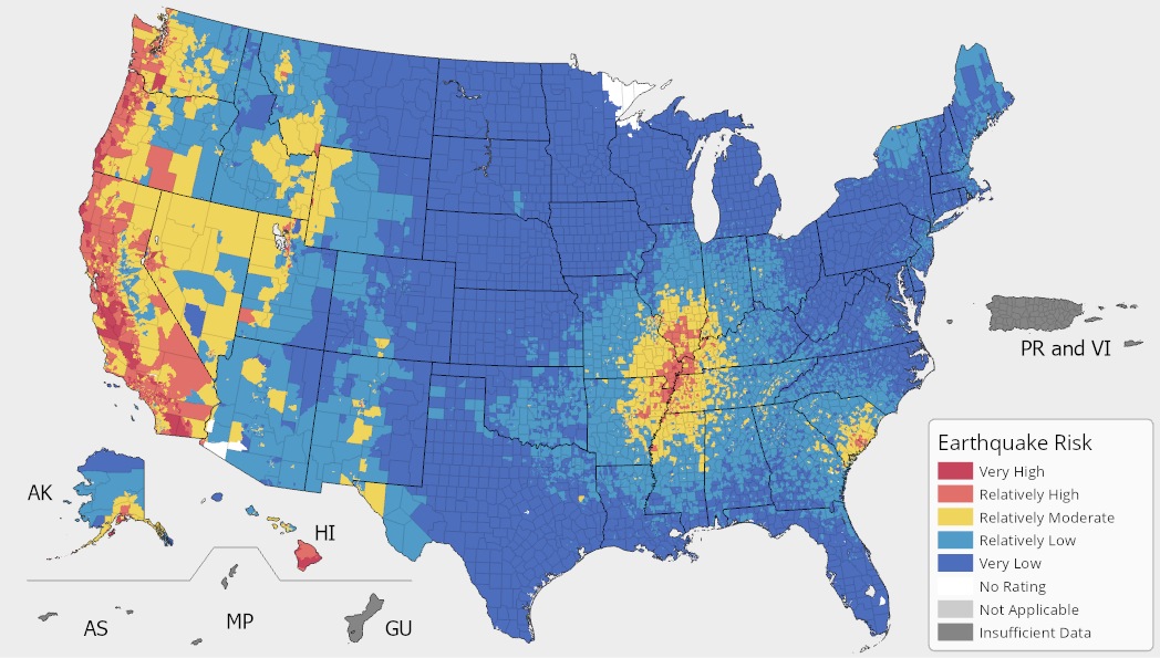
In the National Risk Index, an Earthquake Risk Index score and rating represent a community's relative risk for Earthquakes when compared to the rest of the United States. An Earthquake Expected Annual Loss score and rating represent a community's relative level of expected building and population loss each year due to Earthquakes when compared to the rest of the United States.
Earthquake Exposure
An Earthquake exposure value represents a community's building value (in dollars) and population (in both people and population equivalence) exposed to Earthquake.
Earthquake Annualized Frequency
An Earthquake annualized frequency value represents the modeled frequency of Earthquake hazard occurrences (events) per year.
Source Data
FEMA's Hazus Estimated Annualized Earthquake Losses for the United States (also known as the P-366 Study)
U.S. Geological Survey's Probability of Minor-Damage Earthquake Shaking Raster
Earthquake Historic Loss Ratio
An Earthquake historic loss ratio is the representative percentage of the exposed consequence type value (building or population) expected to be lost due to an Earthquake hazard occurrence.
Earthquake Processing Methodology
For comprehensive details about the Earthquake processing methodology, see the National Risk Index Technical Documentation.